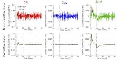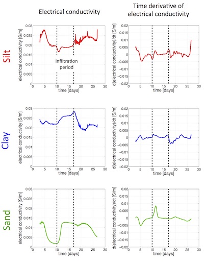
Accurately determining hydraulic properties (and hence lithologies) in the vadose zone is a challenge. Laboratory experiments using core samples from the field are not typically representative of true field conditions, and direct hydrologic field measurements are typically limited in spatial extent. Here, we propose to resolve lithology in the vadose zone though geophysical methods, and specifically by examining temporal changes in electrical conductivity. Because different lithologies have different hydraulic properties, their water contents react differently to infiltration and drainage over time. By simulating infiltration through various randomly-generated vadose zone models, we find that water content in clays and silts generally show very little variation over time, whereas water content in sands shows rapid and significant changes over time. Although water content cannot be directly measured in the field, it is highly correlated with electrical conductivity. Therefore, we examine the time derivatives of electrical conductivity data to monitor the rates of change in water content over time. Because geophysical measurements are often noisy, we estimate derivatives using the continuous wavelet transform rather than standard numerical differentiation. From implementing this method on synthetic noisy data, we find that rates of change in water content, and hence electrical conductivity, are consistently close to zero in clays, slightly variable in silts, and highly variable in sands. Application of this method to electrical conductivity probe data from a region of known lithology supports these observations and suggests that examining temporal changes in electrical conductivity can indeed resolve different lithologies in the vadose zone.

Conference Abstracts
American Geophysical Union 2014 [poster]